
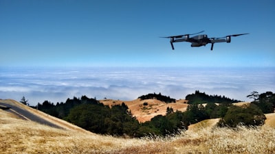
Autonomous drone navigation in dense, cluttered environments represents one of the most complex challenges in modern robotics. Traditional systems typically split the problem into two independent stages: first they build a geometric map of the surroundings, usually based on binary occupancy (obstacle yes or no), and then they plan a safe trajectory over that map. This separation has limitations: occupancy information is poor for trajectory optimization, and the stage-by-stage treatment increases latency and reduces robustness. An emerging alternative is to use a unified representation based on signed distance functions (SDF), which encodes the distance to the nearest obstacle and provides a continuous, rich gradient for planning and optimization. This article explores how combining an octree residual network (OREN) for online SDF reconstruction and a planner based on maximal collision-free bubbles (Bubble★) enables a quadrotor to navigate in real time with efficiency and formal guarantees, and how companies like Q2BSTUDIO can integrate these technologies into custom software solutions for industry.
The signed distance function (SDF) assigns to each point in space a value indicating the distance to the nearest obstacle, positive outside obstacles and negative inside. Unlike a binary occupancy map, the SDF provides smooth and differentiable information, essential for gradient-based trajectory optimization algorithms. Moreover, the SDF allows efficient collision detection: if the value at the drone's position is less than the vehicle radius, a collision occurs. This property is key for planners that can exploit distance information to grow collision-free regions. In recent years, deep learning methods have shown great accuracy in estimating SDFs from point clouds, but they are often too slow for real-time applications. This is where the Octree REsidual Network (OREN) architecture comes in, combining an explicit octree prior with an implicit neural residual. The octree provides an efficient volumetric structure for fast queries, while the neural residual refines the estimation to achieve sub-voxel accuracy. This synergy achieves performance comparable to volumetric methods in speed, but with the accuracy and differentiability of neural networks. Reported experiments show that OREN improves SDF estimation by 22% over traditional baselines and can run on embedded drone hardware with limited resources.
In parallel, the Bubble★ planner leverages the distance information from the SDF to build maximal collision-free bubbles: spheres that expand until they touch the nearest obstacle. Instead of exploring a discrete grid state space, Bubble★ creates a graph where each node is a bubble and edges represent feasible transitions between bubbles. This dramatically reduces the number of collision checks compared to a classic grid-based A★. The planner offers formal guarantees of termination, completeness (if a path exists it finds it) and failure detection (if none exists it reports it). The resulting bubble sequence forms a safe corridor for trajectory optimization, which can be smoothed using techniques like least squares or splines. In tests with a real quadrotor, Bubble★ finds trajectories up to 90 meters in cluttered environments in just 1-3 seconds, while baseline methods take up to 10 seconds for the same scenario. This efficiency is crucial for applications such as industrial inspection, warehouse logistics, or emergency response, where the drone must react in milliseconds to environmental changes.
From a business perspective, integrating real-time SDF mapping and distance-accelerated planning into a commercial product requires more than a cutting-edge algorithm. It demands a robust software architecture that handles sensor data capture (LIDAR, depth cameras), OREN model inference on embedded processing units (NVIDIA Jetson, Qualcomm RB5), ground station communication, and flight controller interface. Additionally, the software must be modular, maintainable, and scalable for different hardware configurations and operational scenarios. Here is where Q2BSTUDIO, as a software and technology development company, brings its expertise. Q2BSTUDIO offers artificial intelligence services that allow designing and training customized OREN models for each client, optimizing performance according to sensor type and environment. It also develops custom software and cross-platform applications, including flight control systems, user interfaces, and data pipelines. Integration with cloud services (AWS, Azure) is essential for storing maps, processing historical data, and deploying drone fleets with remote monitoring. Q2BSTUDIO has experience in AWS and Azure cloud, implementing serverless solutions for point cloud preprocessing and real-time model updates.
Cybersecurity is another critical pillar in connected autonomous systems. A poorly protected drone can be compromised, allowing unauthorized access to flight control or sensitive data. Q2BSTUDIO offers cybersecurity and pentesting services to ensure that communications, storage, and AI models are protected against attacks. Likewise, business intelligence (BI) plays a role in fleet monitoring: through Power BI dashboards, operators can visualize performance metrics, trajectory anomalies, and energy efficiency. Q2BSTUDIO develops BI and Power BI solutions that integrate with drone telemetry systems, providing a complete operational overview. Finally, the trend toward autonomous AI agents that make in-flight decisions without human intervention is increasingly relevant. Q2BSTUDIO researches and develops AI agents based on SDF and real-time planning that can adapt to dynamic environments, such as warehouses with moving personnel or search-and-rescue scenarios.
In conclusion, the combination of real-time SDF with planners that exploit distance information represents a qualitative leap in autonomous UAV navigation. The OREN and Bubble★ architecture demonstrates that it is possible to achieve efficiency, accuracy, and formal guarantees on embedded hardware, opening the door to reliable commercial applications. However, bringing these innovations from the lab to the market requires careful software engineering, integration with cloud infrastructure, robust cybersecurity, and BI tools that enable operation at scale. Q2BSTUDIO, with its focus on custom applications, AI, cloud, cybersecurity, and business intelligence, is ideally positioned to accompany drone, logistics, and inspection companies in this transformation process. The future of autonomous aerial mobility depends on solid software ecosystems, and at Q2BSTUDIO we work to build them.