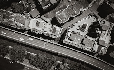
Urban scene classification in satellite and drone imagery is a growing challenge for sectors such as urban planning, precision agriculture, and infrastructure management. Traditional computer vision techniques fall short when faced with high intra-class variability (two parks can look very different) and inter-class similarity (a dense residential area may be confused with an industrial estate). To address these limitations, DMFNet (Dual-backbone Multiscale Feature Fusion Network) emerges as an innovative framework combining two pretrained backbones, multiscale fusion with residual propagation, and spatial attention. This article provides an in-depth analysis of its architecture, its application in urban classification, and the opportunities it creates for companies looking to integrate artificial intelligence into their processes.
DMFNet builds on the premise that no single convolutional network captures all relevant scales. By employing two backbones (e.g., ResNet-50 and EfficientNet-B3), complementary representations are extracted: one specializing in fine textures and the other in global shapes. The key lies in the multiscale fusion module, which connects each resolution level of both backbones via residual connections. This allows information to flow from deeper layers to shallower ones, enriching feature maps without losing detail. Additionally, a spatial attention block weights the most informative regions — such as road intersections or high-density building areas — improving discrimination in complex multi-object scenes.
Training follows a two-phase strategy: first the backbones are frozen to stabilize pretrained representations, then selected layers are unfrozen to adapt to the urban domain. This technique avoids overfitting and accelerates convergence, achieving an average accuracy of 97.46% ± 0.14% on the AID dataset. However, beyond the numbers, what matters is that DMFNet demonstrates how combining dual architectures, residual fusion, and spatial attention can overcome the bottlenecks of classic models.
From a business perspective, implementing systems like DMFNet opens the door to advanced artificial intelligence solutions that transform geospatial data into operational decisions. For example, a logistics company can automatically classify loading and unloading zones in aerial images, optimizing routes. A city council can monitor unplanned urban sprawl. This is where the value of a technology partner like Q2BSTUDIO comes in, specialized in developing custom software applications that integrate AI models in cloud or hybrid environments.
DMFNet's architecture is highly modular: backbones can be replaced with lighter or problem-specific versions, and multiscale fusion can scale to more than two branches. This makes it an ideal foundation for projects requiring landscape classification, change detection, or semantic segmentation. Moreover, the inclusion of spatial attention allows the model to ignore irrelevant zones, reducing false positives in critical applications such as detecting informal settlements or natural hazard assessment.
For such a solution to work in production, robust cloud infrastructure is essential. Q2BSTUDIO offers AWS and Azure services that allow deploying models like DMFNet with automatic scaling, load balancing, and high availability. Cybersecurity also plays a key role: when handling sensitive data from critical infrastructure, it is necessary to implement encryption protocols, multi-factor authentication, and periodic pentesting. The company integrates these practices into every project, ensuring both model and data are protected.
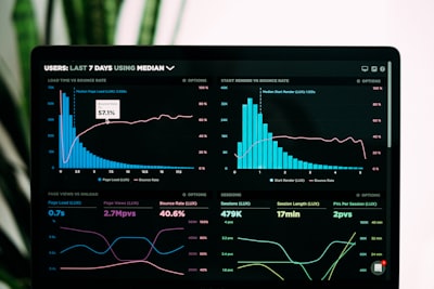
Another differentiating aspect is the ability to combine visual classification with tabular data through Business Intelligence tools. For instance, once DMFNet classifies urban zones into categories (residential, commercial, green, industrial), those results can feed a Power BI dashboard that cross-references images with demographic or mobility indicators. Q2BSTUDIO builds these bridges between computer vision and BI, enabling clients to make data-driven decisions enriched with visual insights.
The trend toward autonomous AI agents also finds fertile ground here. An agent trained with DMFNet could, for example, periodically inspect updated orthophotos and report changes in urban morphology without human intervention. The company is exploring these capabilities in its R&D labs, offering clients a clear roadmap toward intelligent automation.
In conclusion, DMFNet represents a significant advance in remote scene classification, but its true potential is unlocked when integrated into robust business ecosystems. From model selection to cloud deployment, through cybersecurity and business analytics, every technical layer must be coordinated. Q2BSTUDIO provides that integration layer, turning cutting-edge research into operational solutions that generate real value. If your organization is looking to implement urban classification systems with artificial intelligence, the journey starts with a solid architecture like DMFNet and a team that understands both the algorithm and the business.