
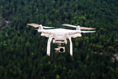
Autonomous route planning for unmanned aerial vehicles (UAVs) in environmental monitoring missions represents a first-order technical challenge. Maximizing geographic coverage while minimizing energy consumption, navigating obstacles, and adapting to changing weather conditions requires robust algorithms and a flexible software architecture. This article explores current solutions and how technology development companies, such as Q2BSTUDIO, can add value through custom applications, artificial intelligence, cybersecurity, and cloud services.
The state of the art in UAV routing for coverage shows significant fragmentation. Most studies focus on pure coverage formulations, multi-UAV coordination, and energy optimization, but barely 10% explicitly address weather uncertainty or obstacle-dense environments. Validation is done almost exclusively in simulators, creating a simulation-to-reality gap. To bridge that gap, systems are needed that integrate real-time data, react to strong winds, rain, or vegetation changes, and learn from experience.
From a business perspective, implementing these capabilities involves much more than choosing an algorithm. A complete digital ecosystem is required: fleet management platforms, visualization dashboards, secure cloud storage, and cybersecurity mechanisms to protect data integrity and communication links. This is where the specialized services of Q2BSTUDIO make sense. The company offers custom software development that enables customization from the route planner to the operator dashboard. For example, an environmental monitoring system can integrate artificial intelligence modules to predict optimal coverage based on historical and weather data, or employ autonomous AI agents that readjust the route in flight without human intervention.
The cloud plays a crucial role in scalability and flexibility. By deploying backend services on AWS or Azure, distributed processing of sensor data is achieved, as well as the ability to store terabytes of images and measurements. Q2BSTUDIO has experience in cloud migrations and secure infrastructure setup, as described in its cloud AWS/Azure services. Furthermore, integrating Power BI transforms flight data into interactive reports on covered areas, energy consumption, and anomaly detection, facilitating decision-making for field teams and sustainability officers.
Cybersecurity cannot be an afterthought. UAVs are potential attack vectors: from telemetry interception to malicious command injection. Therefore, any autonomous routing solution must incorporate communication encryption, multi-factor authentication, and periodic audits. Q2BSTUDIO offers cybersecurity services including penetration testing and hardening of embedded systems, ensuring the monitoring platform withstands both physical and cyber threats.
Another emerging trend is the use of AI agents that act as virtual co-pilots. These agents, trained through reinforcement learning, can explore alternative routes when an obstacle or low-signal zone is detected. Q2BSTUDIO researches in this field and develops prototypes that combine geometric planning with deep neural networks, all within a custom software framework that ensures interoperability with commercial sensors and protocols like MAVLink.
In summary, the path to maximum coverage in environmental monitoring with UAVs involves integrating advanced planning algorithms, cloud infrastructure, real-time data analytics, and strong security measures. Companies that adopt a comprehensive strategy, such as the one proposed by Q2BSTUDIO, are better positioned to bridge the simulation-to-reality gap and deliver operational, scalable, and reliable solutions. Academic research provides the theoretical foundation; software engineering turns them into practical tools.