
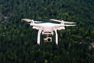
In the field of autonomous aerial robotics, the loss of GPS signal or degraded communications severely compromises the ability of onboard perception systems to recover the absolute metric scale of the scene. Large Language Model (LLM) and Vision-Language Model (VLM) based planners are increasingly adopted as high-level agents for embodied systems, but our experimental research reveals that five state-of-the-art VLMs suffer from spatial scale hallucinations, with median area estimation errors exceeding 50%. This is no trivial problem: a drone flying over a crop field or an urban area needs to know real dimensions to make safe decisions, such as avoiding obstacles or calculating landing routes. To address this need, we propose VehAnchor, a lightweight, deterministic geometric perception skill designed as a callable tool for any LLM-based agent. VehAnchor recovers Ground Sample Distance (GSD) from ubiquitous environmental anchors: small vehicles detected via oriented bounding boxes, whose modal pixel length is robustly estimated through kernel density estimation and converted to GSD using a pre-calibrated reference length. The tool returns both a GSD estimate and a composite confidence score, enabling the calling agent to autonomously decide whether to trust the measurement or fall back to alternative strategies. On the DOTA v1.5 benchmark, VehAnchor achieves a median GSD error of 6.87% on 306 images. Integrated with SAM-based segmentation for downstream area measurement, the pipeline yields a median error of 19.7% on a 100-entry benchmark, with 2.6 times lower category dependence and 4 times fewer catastrophic failures than the best VLM baseline. These results underscore the necessity of equipping agents with deterministic geometric tools for safe spatial reasoning.
From a technical and business perspective, VehAnchor represents a paradigm shift in how autonomous systems handle metric uncertainty. Instead of delegating scale estimation to neural networks prone to hallucinations, it employs a deterministic method based on projective geometry, requiring no additional training and being computationally lightweight. This approach aligns perfectly with the needs of sectors such as precision agriculture, infrastructure inspection, surveillance, and logistics. Companies developing computer vision solutions for drones can integrate VehAnchor as a trust module, improving system reliability without significantly increasing computational load. In this context, Q2BSTUDIO positions itself as a strategic ally to implement such geometric skills in real environments. Our expertise in developing custom software allows us to adapt solutions like VehAnchor to specific use cases, whether integrating vehicle detection with semantic segmentation systems or connecting GSD estimates with cloud analysis platforms.
The scalability of VehAnchor directly benefits from cloud infrastructures such as AWS or Azure. By deploying the pipeline in the cloud, autonomous agents can invoke the tool on demand, process large volumes of images, and store results for further analysis. Furthermore, combining it with Business Intelligence services (Power BI) enables visualizing scale and area metrics in interactive dashboards, facilitating real-time decision-making. For example, a drone fleet manager can monitor the accuracy of GSD estimates over time and detect deviations indicating the need for recalibration. Cybersecurity also plays a critical role: as geo-spatial data may include sensitive information, Q2BSTUDIO offers AI and cybersecurity services to ensure the integrity and confidentiality of transmissions and storage of measurements.
AI agents are the end users of VehAnchor. By providing a deterministic and reliable tool, these agents can make informed decisions without relying on typical VLM hallucinations. Imagine a drone that needs to determine whether a suspicious vehicle in a restricted area has the appropriate size to be a real target: VehAnchor drastically reduces false positives by offering a verifiable metric scale. This same principle applies to autonomous navigation in GPS-denied environments, where accurate ground distance estimation is essential for collision avoidance. The applications are countless, from terrain mapping to package delivery. Q2BSTUDIO, with its experience in AI agents and process automation, can help companies incorporate VehAnchor into their workflows, either as part of an embedded system or as a cloud service callable from any platform.
In conclusion, VehAnchor demonstrates that combining classical geometric techniques with the flexibility of LLM-based agents offers a viable path to overcome VLM limitations in spatial reasoning tasks. The low error rate, category independence, and robustness against catastrophic failures make VehAnchor an indispensable tool for any autonomous system operating under adverse conditions. Companies that invest in integrating such skills into their custom software solutions and cloud platforms will gain a significant competitive advantage. Q2BSTUDIO is ready to accompany this process, offering everything from multiplatform application development to the implementation of AI and cybersecurity infrastructures, all with the goal of making autonomous aerial robotics safer, more accurate, and more reliable.